The neighborhood that many of our ancestors first called home in America underwent major changes during the mid twentieth century. Row upon row of tenement houses were razed and replaced by low to middle income housing projects, to raise the standard of living for the residents of Manhattan’s lower east side. Although most of the buildings our ancestors once called home, as well as the streets they roamed, are long gone, through old maps and photos, we can travel back in time to see their new home as it looked to them.
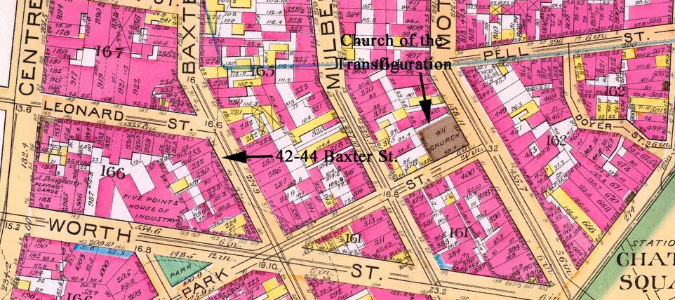
Map dated 1891 shows the location of 42 and 44 Baxter St.
This map dated 1891 shows the location of 42 and 44 Baxter St. Examining Ellis Island immigration documents, an overwhelming majority of immigrants from Craco reported this as their destination in the New World. Although the buildings were destroyed in the early twentieth century for the construction of the City of New York Clerk’s Office, this area remains an important part of the Crachesi migration to America. Directly across Baxter St. from this address is now Columbus Park. The park, originally called Mulberry Bend Park, replaced slum housing with trees, grass and flowers. The park opened in the summer of 1897 with bench lined curved walkways and an expansive open grassy area. It was renamed Columbus Park in 1911. No doubt many of our ancestors roamed this urban oasis in an attempt to escape the overcrowded and unfamiliar life in New York.
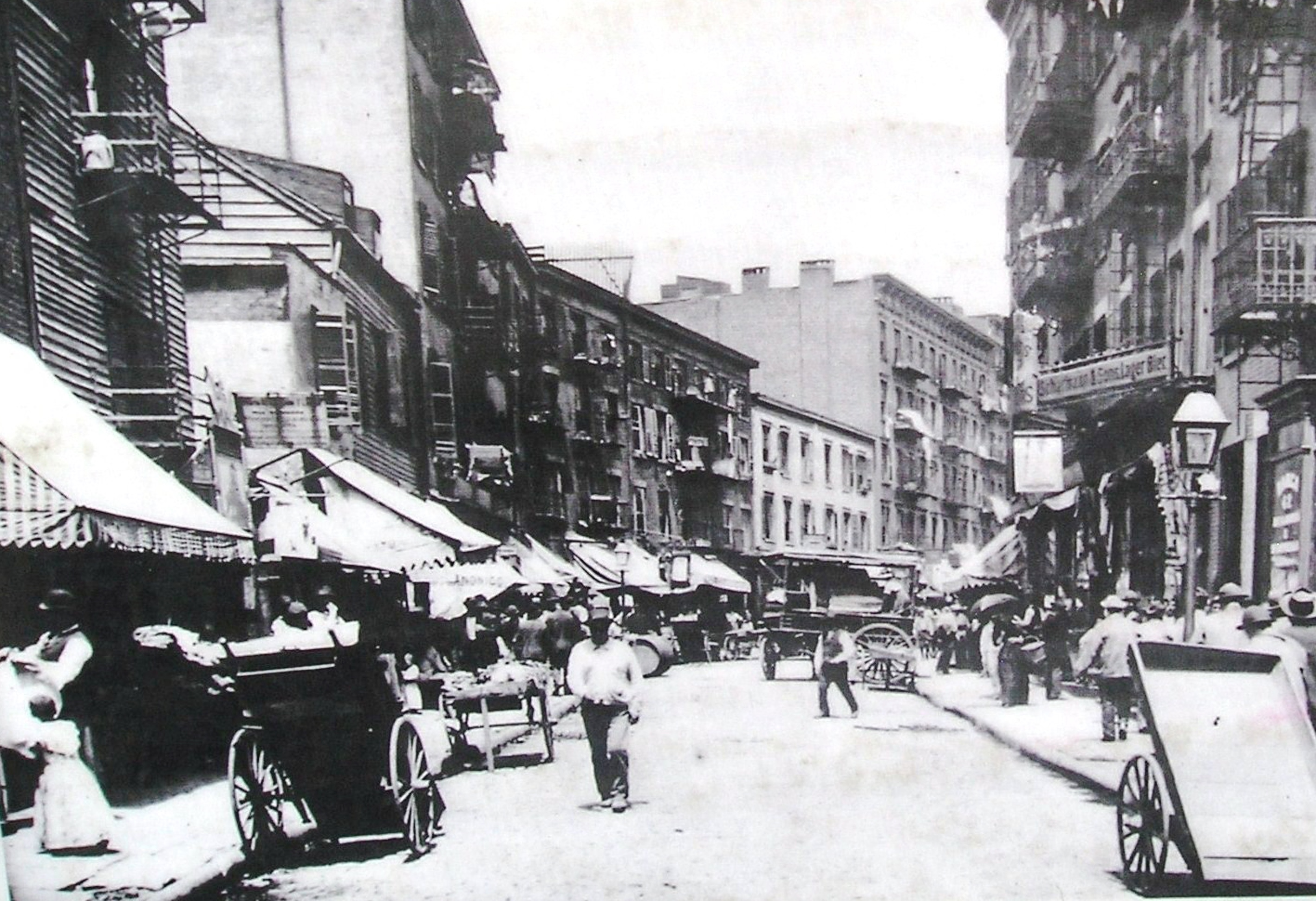
Mulberry Bend, circa 1890. The park would soon replace the buildings.
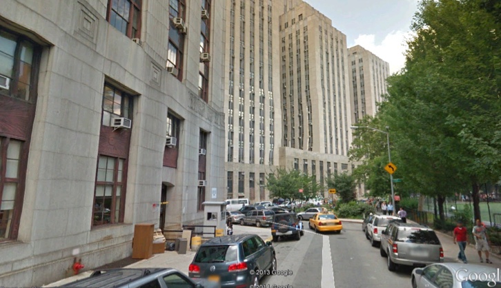
On the left is where 42 and 44 Baxter St. once stood, now the rear of the City of New York Clerk’s Office. The building straight ahead is the City of New York Criminal Court Building, and Columbus Park can be seen on the right. (Photo from Google Earth.)
The area located just south (across Park Row) from Baxter Street also was a popular area inhabited by many Crachesi immigrants. Their main house of worship was San Joachim’s Church, located at 22-26 Roosevelt St. By 1926, the large influx of Italian-American immigrants created the need for a larger, more modern Church in the neighborhood. The tiny Church of San Giuseppe (founded in 1887) moved one-half block north, from 65 Catherine St. to a new, larger Church at 5 Monroe St. The block surrounded by Catherine, Monroe, Cherry and Market Streets, including Hamilton St. was notorious for squalid living conditions and became known as “Lung Block” for the prevalence of tuberculosis. In 1933, the area was demolished and construction of Knickerbocker Village, the twin 13 story buildings with 1,590 residents, began. By 1958, most of the areas outlined in black (including San Joachim) had fallen to the wrecking ball in preparation for more housing projects. The Gov. Alfred E. Smith houses, the largest development in the area, containing 12 buildings, all 17 stories tall, housing an estimated 5,700 people on over 21 acres, began with demolition in 1950, and the project was completed on April 1, 1953. Chatham Green Apartments (now condominiums) were finished in 1960. New York City’s Police Headquarters, at One Police Plaza, dates to 1973, although it has undergone numerous renovations and expansions. The 32 story Verizon Telephone Switching Building at 375 Pearl St. opened in 1975, amid much criticism about its negative aesthetics and its impact on the neighborhood.
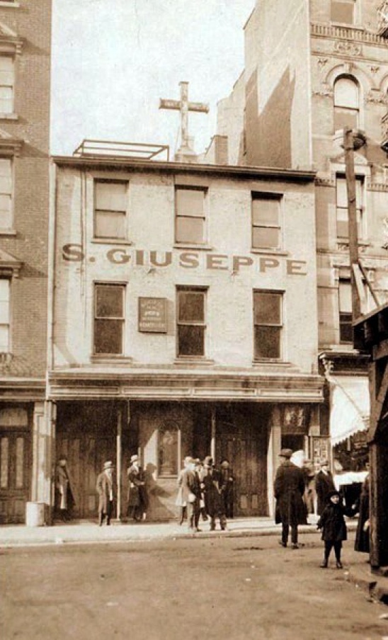
The original Church of San Giuseppe from 1887 to 1926. It was located at 65 Catherine Street, one half block south of the new Church, which was built in 1926.
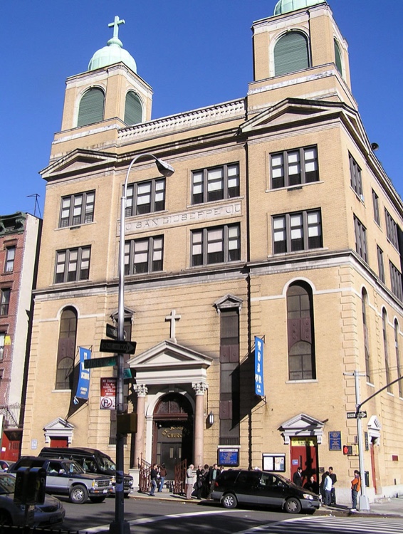
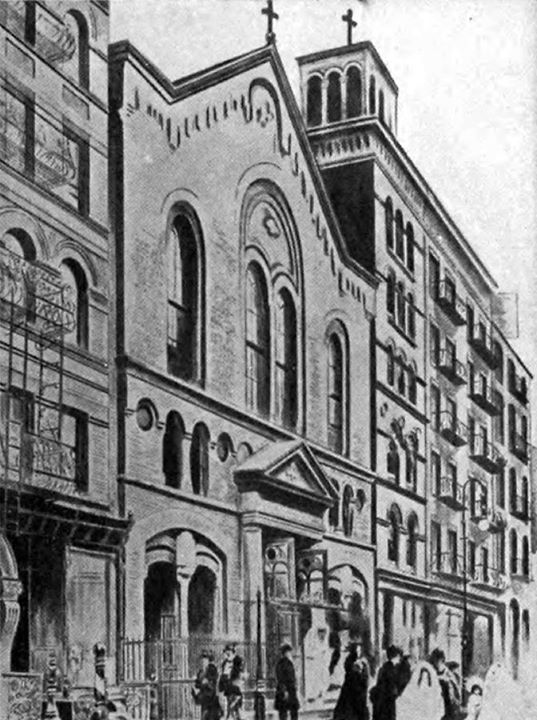
The new Church of San Giuseppe was built in 1926.
The future site of Knickerbocker Village. The now defunct Hamilton St. (Lung Block) is on the left and Monroe St. is on the right. The rear of the new St. Joseph’s Church and its twin steeples can be seen on the right. The skyscrapers in the background are (l. to r.), the Cities Services Building (most recently the AIG building and 70 Pine St.), the Bank of Manhattan Trust Building (40 Wall St. – now a Trump Building), and the Singer building, located at the corner of Broadway and Liberty St., which was sadly demolished in 1968.
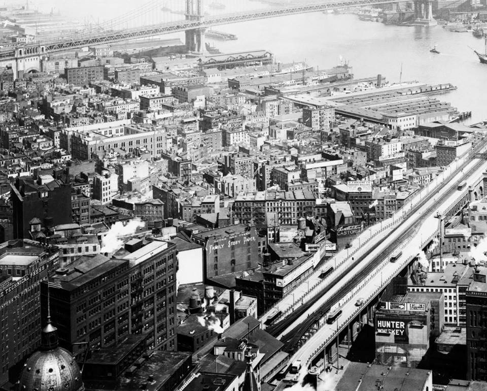
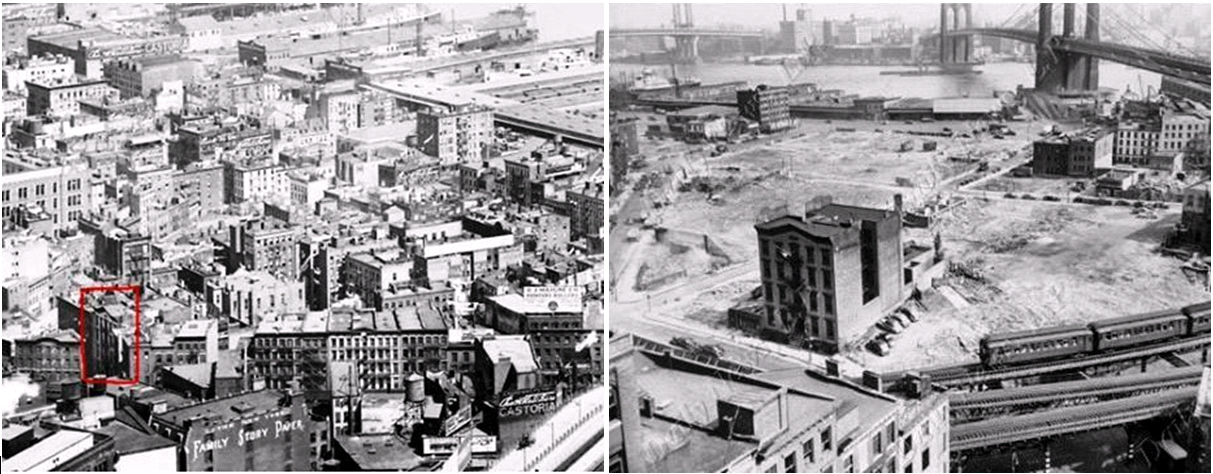
Construction of Knickerbocker Village in 1933, as seen from the East River. The east building’s exterior appears to be nearly complete, while the west building’s structural steel is in place. The large building in the background is the iconic New York City Municipal Building. The building under construction is the U.S. Federal Courthouse located on Foley Square.
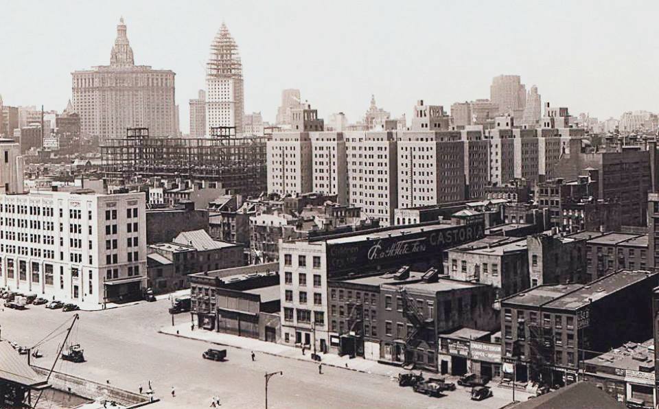
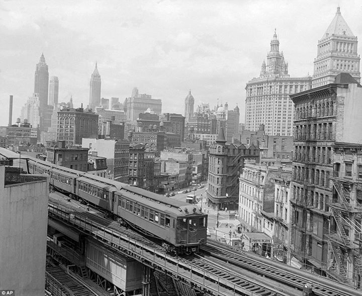
This photo of the Lower East Side was taken from the Woolworth Building (then the tallest building in the world) in 1916. The Manhattan Bridge can be seen in the distance, and the approach to the Brooklyn Bridge in the foreground. The piers and ships docked are a distant memory.
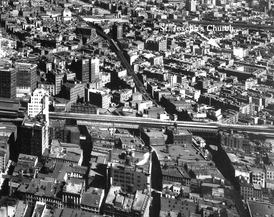
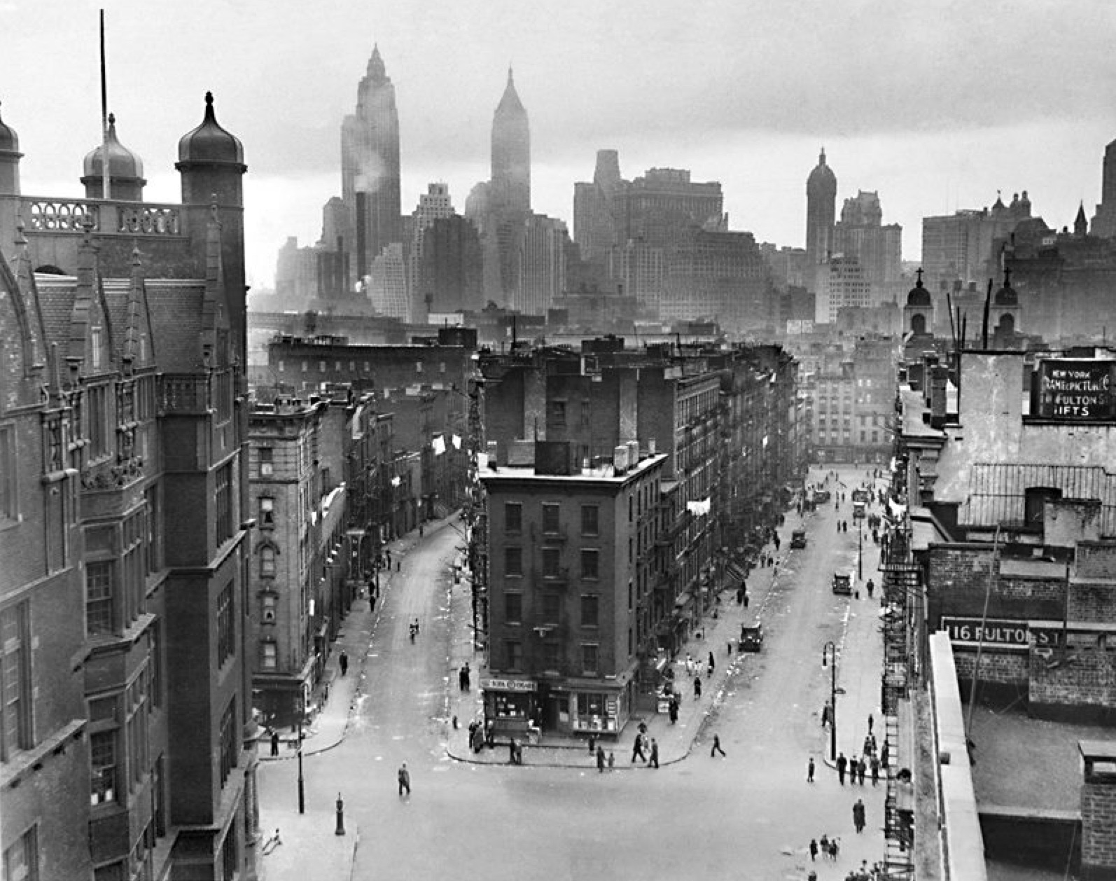
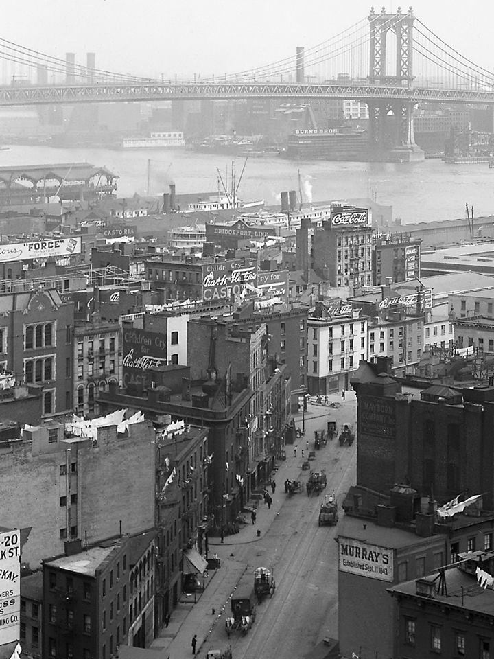
This photo, probably taken from the Cities Services building, is dated 1932. On the top is the approach to the Manhattan Bridge, and the bottom is the Brooklyn Bridge. The dark elevated train tracks can also be seen. New Bowery and Park Row lived in shadows under the rumbling trains connecting this neighborhood with the more modern Midtown area. The new St. Joseph’s Church is labeled in the upper right.
At the left, the 4th Precinct Police Station on Oak St. is outlined in red. The photo on the right was taken in 1950 during the demolition of the neighborhood that would soon become the Gov. Alfred E. Smith housing project. The old station house was among the last structures to be removed, in all likelihood to ensure a police presence remained in the area during these times of change.
Roosevelt St. looking northward from New Bowery and Madison Streets. San Joachim’s Church, located at 22-26 Roosevelt St., is halfway down the block, on the right. This area was razed in 1958 to make way for the Chatham Green Housing Project.
An artist’s rendering of San Joachim’s Church.
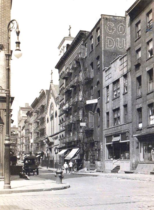
On the left, looking down the now defunct Hamilton St. (Lung Block), towards the Manhattan Bridge. On the right, looking north up Catherine St., from the corner of Monroe St. Notice the front of the “new” St. Joseph’s Church on the right.
New Chambers St. with the Manhattan Bridge and Brooklyn in the background.
New Bowery and the 2nd Ave. el as it appeared in 1954. The buildings in the distance are (l. to r.) Cities Services, City Bank-Farmers Trust, Bank of Manhattan Trust, Singer Bldg., Municipal Bldg., and the Federal Courthouse.
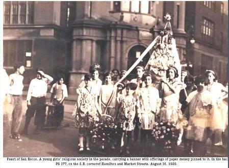
Feast of San Rocco. A young girl’s religious society in the parade, carrying a banner with offerings of paper money pinned to it. In the back, PS177, at the SE corner of Hamilton and Market Streets, August 16, 1929.
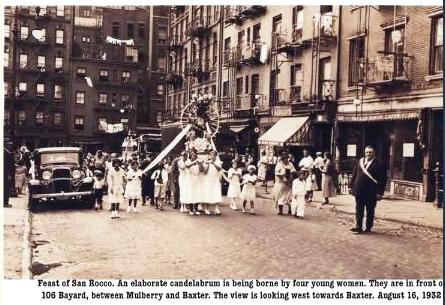
Feast of San Rocco. An elaborate candelabrum is being borne by four young women. They are in front of 106 Bayard St., between Mulberry and Baxter. The view is looking west towards Baxter. August 16, 1932.
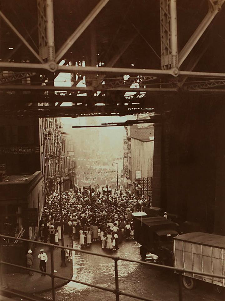
The feast of San Rocco as it passes under the Brooklyn Bridge on Cherry St., 1935.
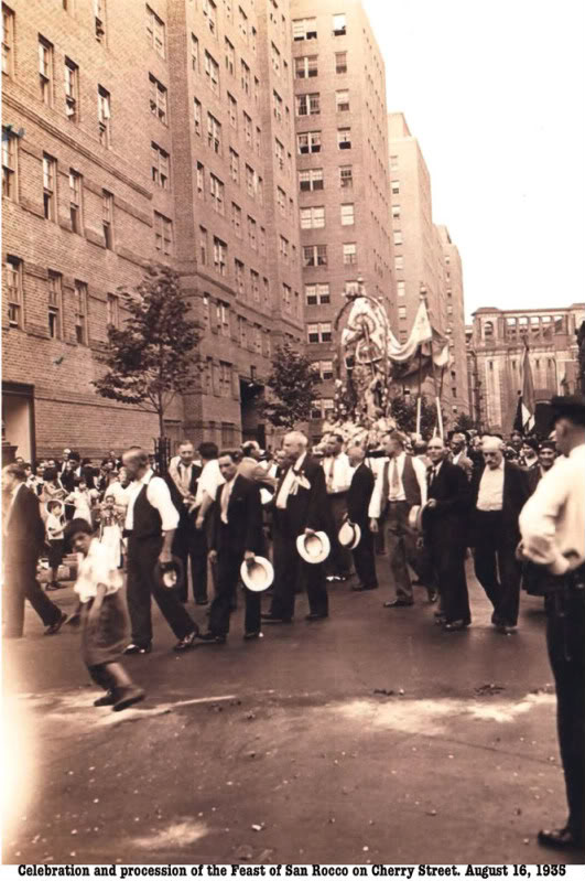
Celebration and procession of the feast of San Rocco on Cherry St. as it approaches Catherine St., August 16, 1936. The buildings on the left are Knickerbocker Village. The procession still follows this route to date.
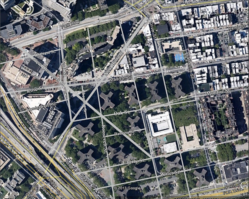
This aerial view of the neighborhood today shows the location of the streets of the past.
*The maps dated 1890 are from Geo. W. & Walter Bromley, Civil Engineers and the Davis Rumsey Map collection. They are not to be used for commercial purposes without express consent.